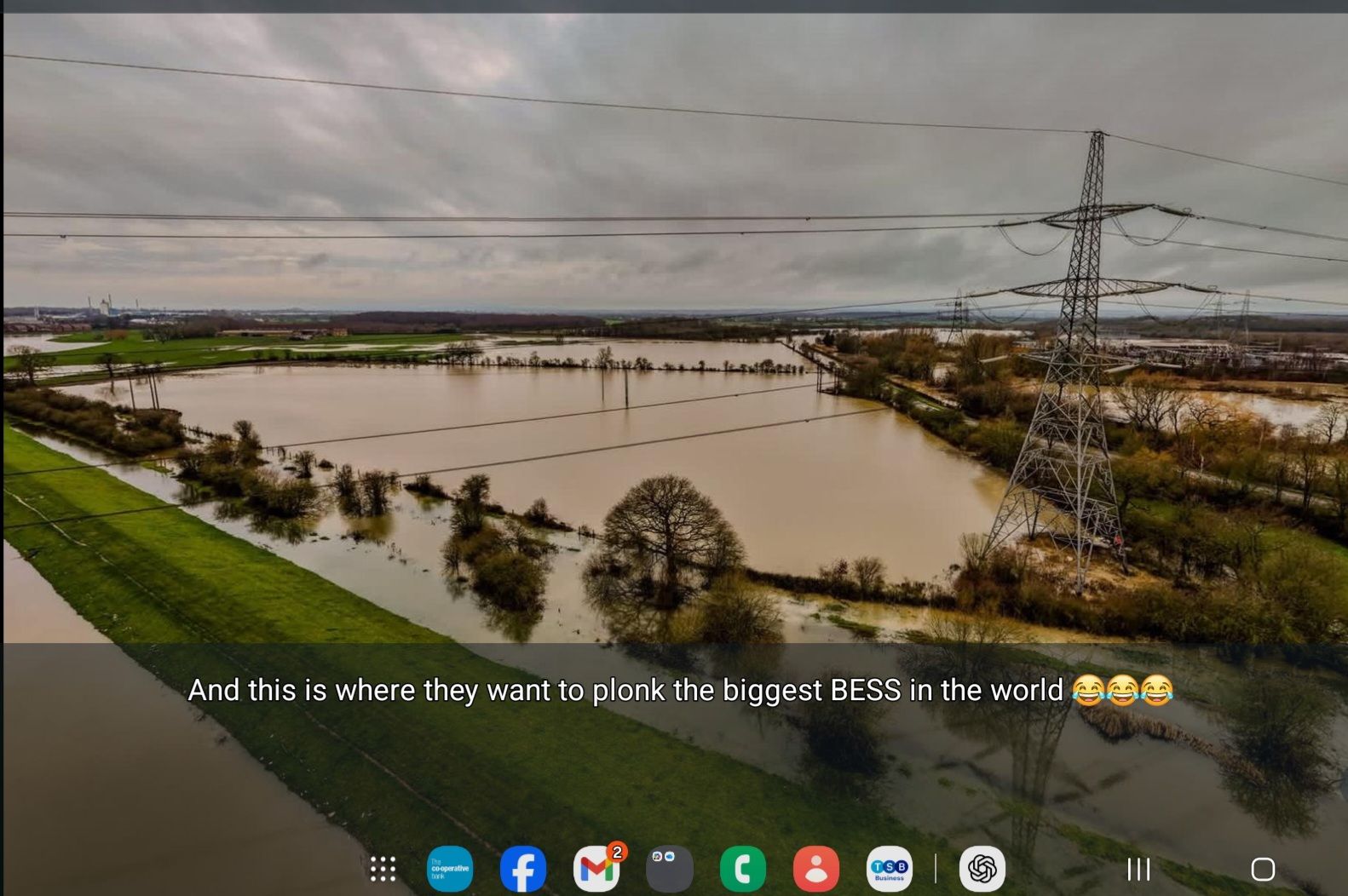
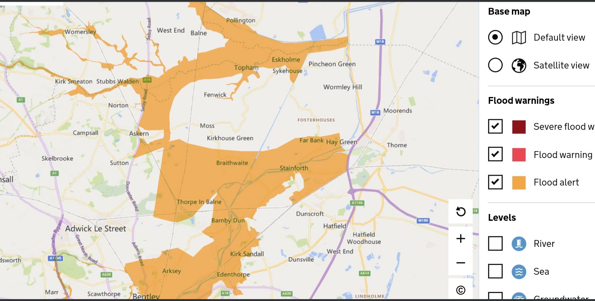
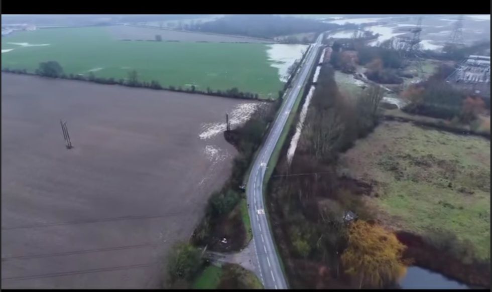
To the planning inspectors, policy advisers and Whitehall lobbyists reading environmental statements from behind a desk, this is a warning , not a slogan.What you are seeing across South Yorkshire, the Humber and the Don catchment right now is not a theoretical risk, a worst-case scenario, or a “modelled outcome”. It is reality.Fields submerged. Roads cut off. Water backing up against embankments, drains and hard infrastructure that was never designed for the volume now forced through it. Drone footage and live flood maps tell a clearer story than any glossy planning application ever could.And yet, despite this, the planning system continues to wave through large-scale infrastructure projects , solar farms, battery storage sites, substations, access roads and grid corridors , on land already proven to flood.This is not resilience. It is denial.
Flood Maps Are Evidence, Not Inconvenience
Flood alerts are too often treated as background noise , something to be “mitigated”, “managed” or footnoted in an Environmental Statement. But flood maps exist for a reason: they show where water will go, not where a developer wishes it wouldn’t.Hard-surfacing, soil compaction, drainage interference and perimeter fencing all change how water behaves. They speed it up, redirect it, displace it. If it doesn’t pool in a field anymore, it ends up somewhere else , usually in villages, on roads, or inside homes.Anyone approving development in flood-prone areas while claiming “no significant impact” is not exercising professional judgement. They are outsourcing the consequences to communities downstream.
Desk Decisions, Ground-Level Consequences.
There is a growing disconnect between those who sign off planning approvals and those who live with the outcomes. From Whitehall offices and consultancy boardrooms, floodplains look like empty space. On the ground, they are part of a fragile system that is already overwhelmed.This winter has shown , again , that climate volatility is increasing, not decreasing. That alone should force caution. Instead, it is being used to justify faster rollout of infrastructure that actively reduces the land’s natural ability to cope with water.That is not adaptation. It is self-contradiction.
Ideology Is No Substitute for Engineering Reality
There is nothing environmentally progressive about ignoring hydrology, soil science and cumulative impact. Real sustainability starts with realism:You do not build critical infrastructure where access is routinely cut off by floodwaterYou do not pretend mitigation measures can replace natural flood storageYou do not sacrifice food-producing land and community safety for targets that cannot account for physical limitsIf inspectors and policymakers cannot pause projects when the land itself is signalling distress, then the planning system has ceased to be precautionary. It has become ideological.
A Line Has to Be Drawn
This is a call for realism , not obstruction.Pause developments in flood-affected zones. Reassess cumulative impacts honestly. Stop treating flood risk as a box-ticking exercise. And above all, stop approving projects that make flooding worse while claiming they make the country greener.Because the water does not care about policy narratives.It goes where physics tells it to go.And when the next flood hits , it will not be the planners or lobbyists wading through it. It will be ordinary people, once again paying the price for decisions made far from the floodplain.
Shane Oxer. Campaigner for fairer and affordable energy

Leave a comment