Today I walked the land around Long Lane, Whiston, beside the proposed Brinsworth / Long Lane 400kV substation site.
What I saw was not an empty wasteland. It was not some forgotten strip of land waiting to be industrialised. It was a living edge of the Rother Valley: Whiston Meadows, woodland, wetland, brook, footpaths, birds, grasses, pylons, open fields and long views across a landscape already carrying the scars of infrastructure.
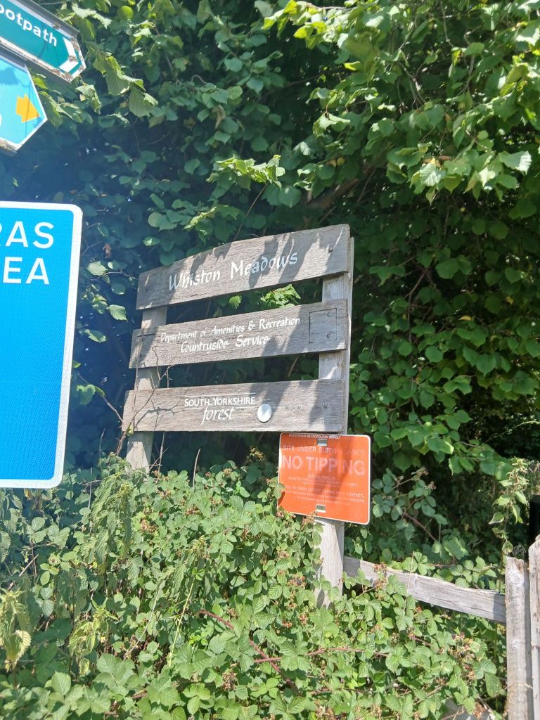
The signs at Whiston Meadows say it clearly: this is a place for “people and nature”. The information board describes meadows, woodlands, wetlands and a brook. It highlights kingfisher, reed warbler, robin, wren, common toad, grass snake and field vole. It marks trails, bird-watching areas and the Whiston Brook corridor. This is not sentimental. It is factual. The area already functions as a green corridor and a public access landscape.
And now, next to this, Rotherham Planning Board is being asked to approve a major 400kV Gas Insulated Switchgear substation at Long Lane.
The officer report describes the application as including gantries, internal access roads, a GIS building, parking, drainage, an emergency diesel generator, lighting, CCTV, permanent access from Long Lane, earthworks, landscaping, biodiversity enhancement, fencing and the permanent realignment of Whiston Footpath 10. The recommendation before councillors is to grant permission, subject to a Section 106 agreement and conditions.
That is not a small utility building. It is major industrial electricity infrastructure.
This is not just about Long Lane
The danger here is that each development is being presented as if it exists in isolation.
Long Lane is “just” a substation.
Whitestone is “just” a solar farm.
The pylon route is “just” an associated grid route.
Old Flatts Farm is “just” a name in connection data.
The transformer movements are “just” traffic management.
The cut-and-fill platform is “just” earthworks.
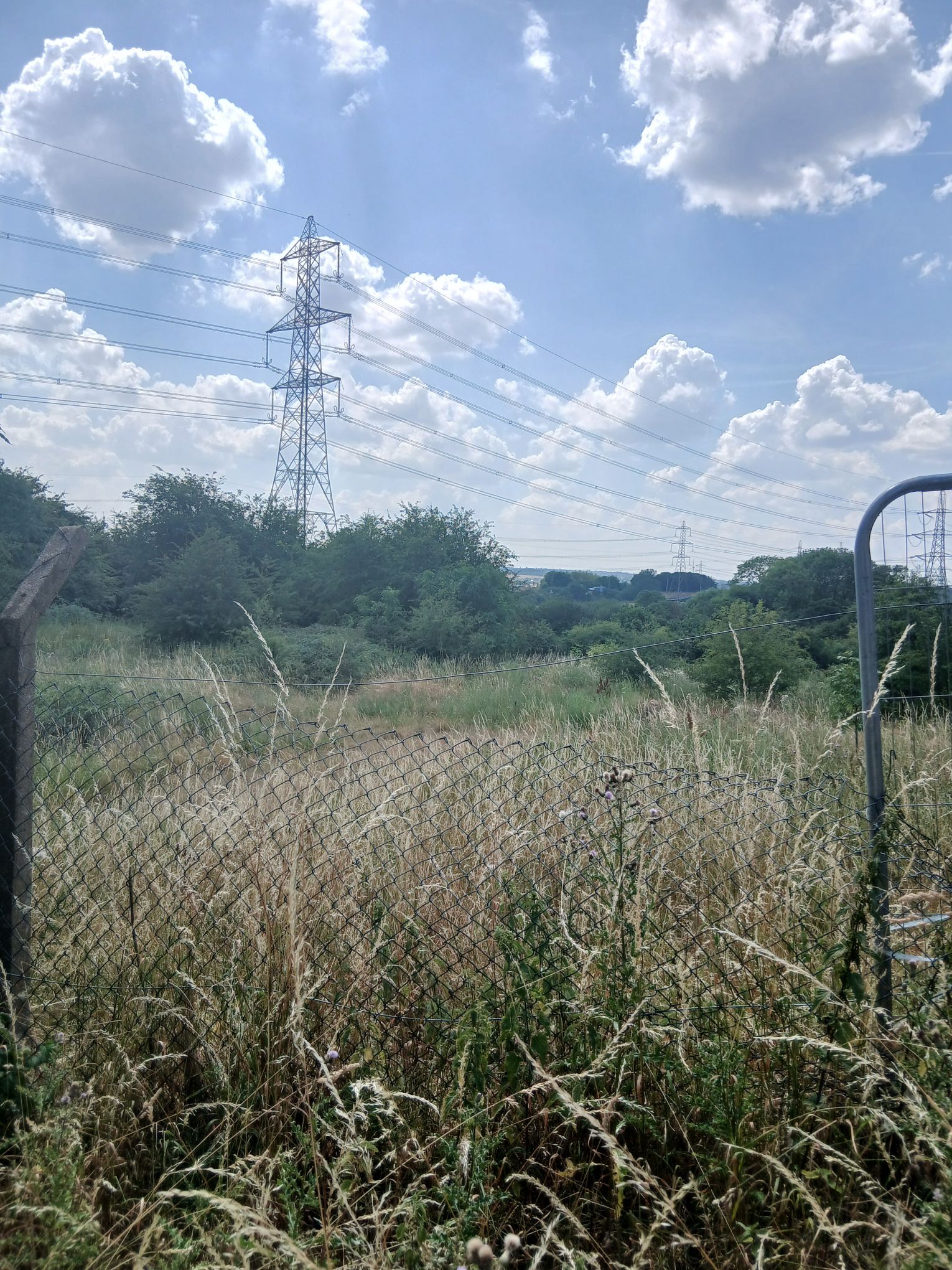

But taken together, they tell a much bigger story: the Rother Valley, from Brinsworth and Whiston through Treeton, Thurcroft, Harthill, Woodall, Conisbrough and beyond, is being drawn into a new electricity corridor.
This is the cumulative impact that residents keep warning about. The landscape is not being changed by one application. It is being changed by a chain of applications, grid works, solar schemes, substations, pylons, access roads, construction compounds, cable corridors and associated infrastructure.
The Planning Board pack itself recognises that large numbers of residents raised the relationship between the Long Lane substation and Whitestone Solar Farm, with objections saying the applications should be considered together and warning about cumulative impacts with solar, housing and other energy infrastructure.
Public reports pack 16072026 0900 Planning Board.pdf
That is the heart of the issue.
The public can see the pattern. The system keeps slicing it into separate decisions.
Whiston Meadows proves this is not a dead landscape
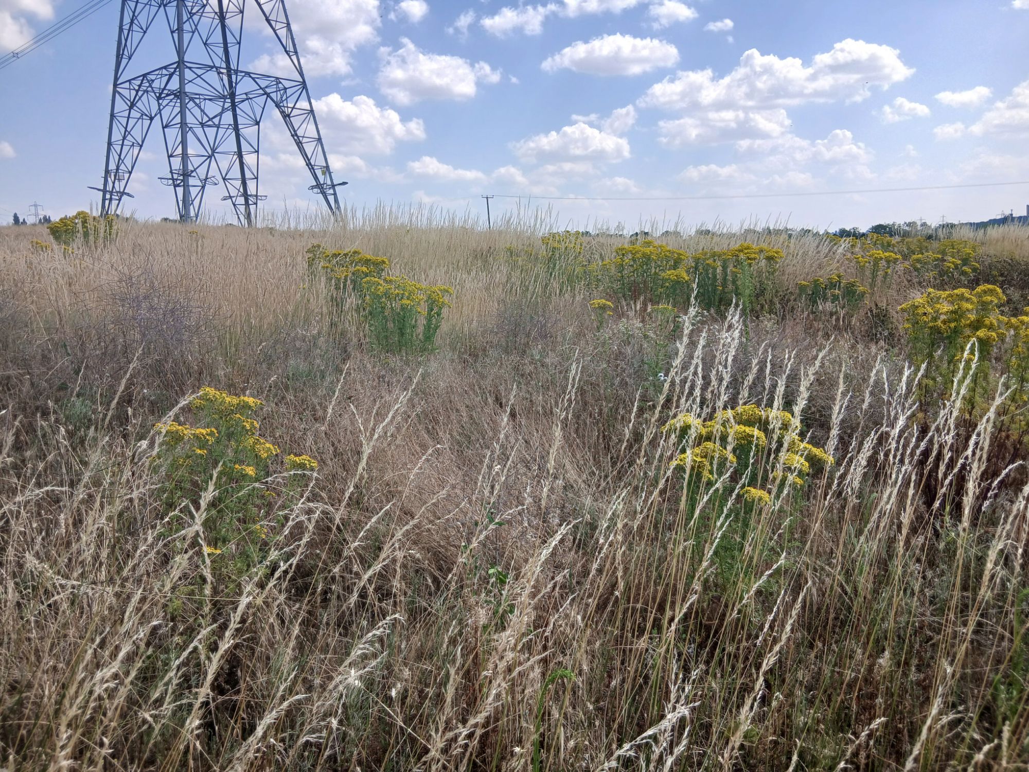
The first photographs from today’s walk show Whiston Meadows and its nature signage. The board describes a site made up of meadows, woodlands, wetlands and a brook , a vital corridor and refuge for local wildlife.
That matters because the planning report repeatedly leans on the idea that this is already an infrastructure-influenced location because of the M1, existing pylons and Brinsworth substation. But that argument cuts both ways.
Yes, the area already carries infrastructure. But that does not mean every remaining field, meadow, brook and footpath should be surrendered to more of it.
There is a difference between a landscape that contains infrastructure and a landscape that is overwhelmed by it.
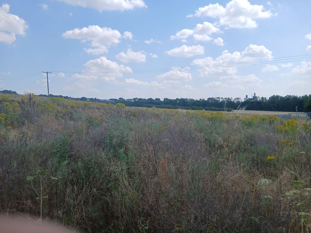
The photographs show that difference. You can see the pylons, but you can also see the grasses, woodland edge, brook corridor, footpaths and open views. This is exactly the sort of landscape that disappears gradually , not in one dramatic act, but through planning decision after planning decision.
The cut-and-fill problem: this is major land engineering
One of the most serious weaknesses in the Long Lane application is the cut-and-fill evidence.
The briefing evidence shows the cut-and-fill drawing is marked “for information purposes only”, is based on 2022 LiDAR data, assumes typical batter slopes and material reuse, and shows Flood Zone 2 extents.
The figures are enormous: approximately 165,552 cubic metres of cut, 164,349 cubic metres of fill, and a reported area of almost 79,000 square metres.
That is not routine levelling. That is a major engineered platform.
This matters because cut and fill determines the final landform. It affects slope stability, settlement, drainage, runoff, visual impact, access gradients, pylon foundations, transformer bases, craneage, bunds, roads and the public footpath.
The Board should not be asked to approve this as though the landform is already fully understood. The right question is not whether a platform can theoretically be engineered. The question is whether this application has already demonstrated that it can be safely engineered here.
Mining and opencast uncertainty should not be left until later
The site sits in a former coalfield landscape. That means ground stability is not a side issue.
The briefing evidence identifies unresolved mining and opencast questions. It states that available records suggest the proposed pylon location is within an area of opencast backfill, that the recent ground investigation was inconclusive on that point, that current understanding is based on limited data from a single phase of investigation, and that further intrusive ground investigation, groundwater monitoring and reappraisal of geotechnical parameters are recommended.
That should be enough to pause the decision.
A 400kV substation is not lightweight infrastructure. It involves transformers, gantries, GIS buildings, foundations, bunds, craneage, roads, pylons and drainage systems. If there is uncertainty about opencast backfill, foundation bearing capacity, groundwater and settlement, those are not post-permission details. They go to the basic suitability of the site.
The question for councillors is simple:
Has the land been proven suitable before permission is granted?
If not, the application should be deferred.
Supergrid Transformers: where exactly are they?
The Planning Board report confirms that the proposed substation will include two Supergrid Transformers, a shunt reactor, a power quality filter, circuit breakers, disconnectors, a relay room and a GIS control building.
That matters because the transformer and infrastructure details must be understood against the cut-and-fill platform.
The briefing evidence raises a serious gap: the Outline Construction Traffic Management Plan anticipates abnormal indivisible load deliveries for “the transformer”, with a transformer assumed at around 202 tonnes net and a 20-axle girder-frame trailer of approximately 314 to 350 tonnes gross. It also notes that highway mitigation may include removal of street furniture, escorts, narrow-road measures and temporary alterations , yet the permanent transformer positions are not clearly labelled on the reviewed plan.
That is not good enough.
Where are the Supergrid Transformers?
Where are their foundations?
Where are the bunds and oil containment areas?
Are they on cut ground, fill ground, or transition ground?
Where are the craneage areas?
What is the total operational loading?
How do those loads interact with mining legacy, opencast backfill, drainage and slope stability?
These are not minor technical points. They are fundamental planning questions.
Traffic is not just “construction inconvenience”
The traffic issue must also be understood properly.
Rotherham’s speaking guidance says ordinary construction details are not usually planning matters. That is fair enough. But abnormal transformer movements, access constraints, highway alterations, mud, dust, HGV routing and four years of substation works are not simply minor inconvenience.
The issue is whether Long Lane and the surrounding highway network can safely and reasonably accommodate the project.
The Council’s own conditions recognise the risk of dust and mud on the highway, requiring best practicable means to minimise dust and requiring steps to prevent mud, dust and other material being deposited on the public highway.
That proves these impacts are real enough to need control. The remaining question is whether conditions are enough, or whether the Board needs fuller pre-determination evidence before approving the scheme.
Water, brook corridors and flood interaction
The photographs of Whiston Meadows show the brook and wetland context. The planning pack acknowledges flood and drainage issues, including earthworks in the south of the site to form the elevated platform, and states that those earthworks encroach into an overland flow route for water draining from a small catchment south of the M1.
The briefing evidence also states that Whiston Brook, the River Rother and Ulley Brook are relevant to runoff, groundwater and flood-risk questions, and that regrading may alter runoff, sediment movement, groundwater pathways and floodplain interaction.
This is why the cut-and-fill platform must be treated as a hydrological intervention, not just an engineering exercise.
The real planning question
This is not about being anti-grid. It is not about opposing every upgrade. It is not about pretending the existing pylons and motorway are not there.
It is about whether a major 400kV substation, pylon interface, Supergrid Transformers, abnormal load routes, earthworks, drainage systems and associated grid infrastructure are being properly assessed before permission is granted.
The strongest and fairest request is not even outright refusal at this stage.
It is deferral.
The Board should defer the application until the missing evidence is published and independently reviewed. That should include a complete cut-and-fill strategy, final levels, transformer and pylon foundation positions, full mining and opencast risk confirmation, groundwater and drainage evidence, abnormal load routing details, National Highways comment on the whole engineered platform, and an annotated infrastructure-over-cut-and-fill plan. The briefing deck makes exactly that recommendation, including independent geotechnical review, National Highways comment on the whole platform, and clear plans showing transformers, bases, bunds, pylons, craneage and access loading.
The line for councillors should be simple:
Decision must follow the evidence , not the timetable.
A final word from the footpath
Walking the site makes the issue clearer than any planning report.
You can stand there and see the future being decided. On one side, Whiston Meadows, the brook, the trails and the wildlife corridor. On the other, pylons, open land, and the proposed footprint of another major energy installation.
If approved without the full evidence, Long Lane will become another precedent. Another piece of the Rother Valley will be taken. Then the next scheme will point to this one as part of the established infrastructure corridor.
That is how landscapes are lost.
Not all at once.
One “isolated” decision at a time.
Shane Oxer. Campaigner for fairer and affordable energy


 SAY NO TO THE DESTRUCTION OF OUR LAND
Leave a comment