You, the Public, Decide
Before reading another polished developer brochure or another carefully worded planning document, take a long look at this landscape.
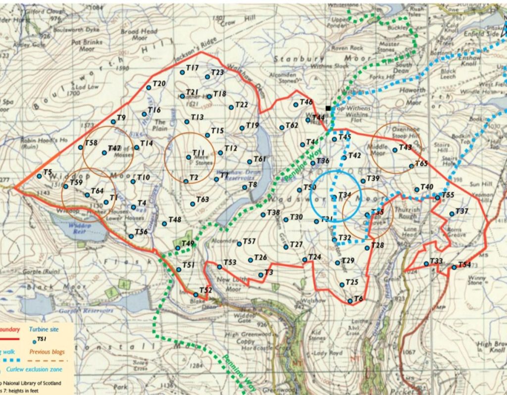
Look at the map.
Look at the ridgelines.
Look at the Pennine Way cutting through the heart of the moors between Widdop Reservoir and Top Withins.
Then, ask yourself one simple question:
Is this really the right place for industrial-scale wind turbines?
The proposal map itself tells a story that technical summaries often fail to capture.
Dozens of turbine locations are spread across one of the most visually open and culturally important upland landscapes in the South Pennines. The red boundary line stretches across moorland ridges, valleys, reservoirs, heritage routes, and open-access countryside used by walkers, photographers, wildlife enthusiasts, and visitors throughout the year.
Running directly through this landscape is one of Britain’s most iconic long-distance walking routes:
The Pennine Way.
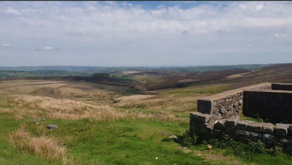
Imagine walking that route today.
You cross exposed moorland plateaus beneath enormous skies. You pass ancient stone walls, upland reservoirs, isolated farm ruins, peat moors, and panoramic valleys stretching for miles across Calderdale and the wider Pennines.
There is silence here.
Space.
Remoteness.
A feeling that modern industrial Britain has been left behind.
Now imagine walking the same route surrounded by towering industrial wind turbines dominating the skyline in every direction.
Because that is the reality shown on this map.
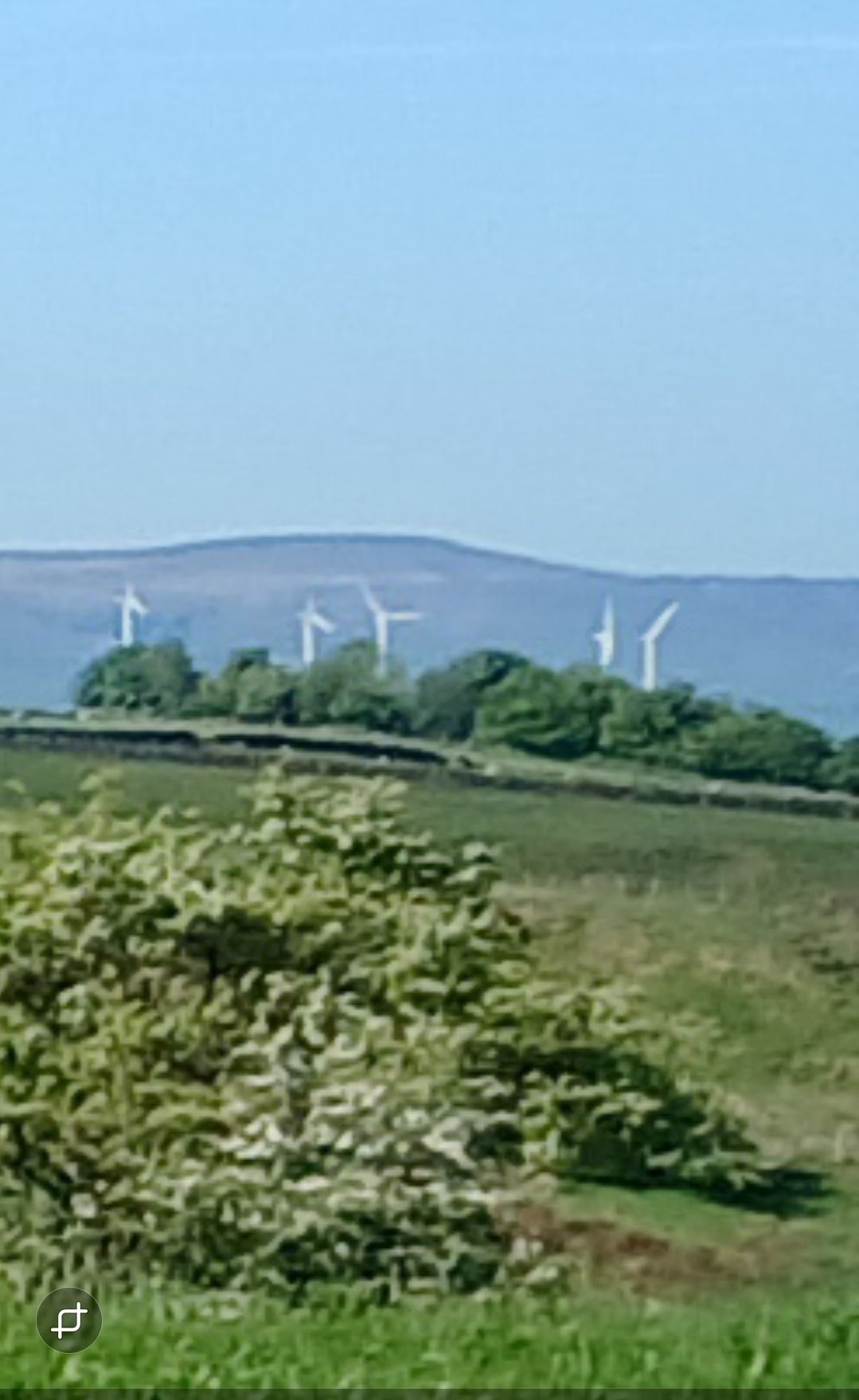
Modern turbines are not small rural structures. Many now exceed 200 metres in height , taller than Blackpool Tower, and approaching the height of major urban skyscrapers. On exposed upland terrain like this, with almost no natural screening, they would become visible across vast areas of the South Pennines.
The very qualities that make this landscape special openness, visibility, wildness, and uninterrupted horizons are the same qualities that make industrial infrastructure impossible to hide.
This is not simply a debate about a few isolated turbines placed discreetly into the countryside.
The map demonstrates something far larger:
A widespread industrialisation of an entire upland landscape system.
The proposed turbines would surround valleys, reservoirs, ridgelines, and walking routes stretching between Widdop Reservoir, Walshaw Moor, and Top Withins.
For walkers approaching from Hardcastle Crags, Hebden Bridge, Haworth, or the Pennine Way itself, the experience of the landscape would fundamentally change.
Instead of open moorland horizons, visitors would encounter rotating turbine blades spread across multiple ridge systems.
Instead of remoteness, there would be permanent industrial presence.
Instead of timeless upland scenery, there would be moving infrastructure dominating the skyline day and night.
And once landscapes like this are industrialised, they rarely recover their original character.
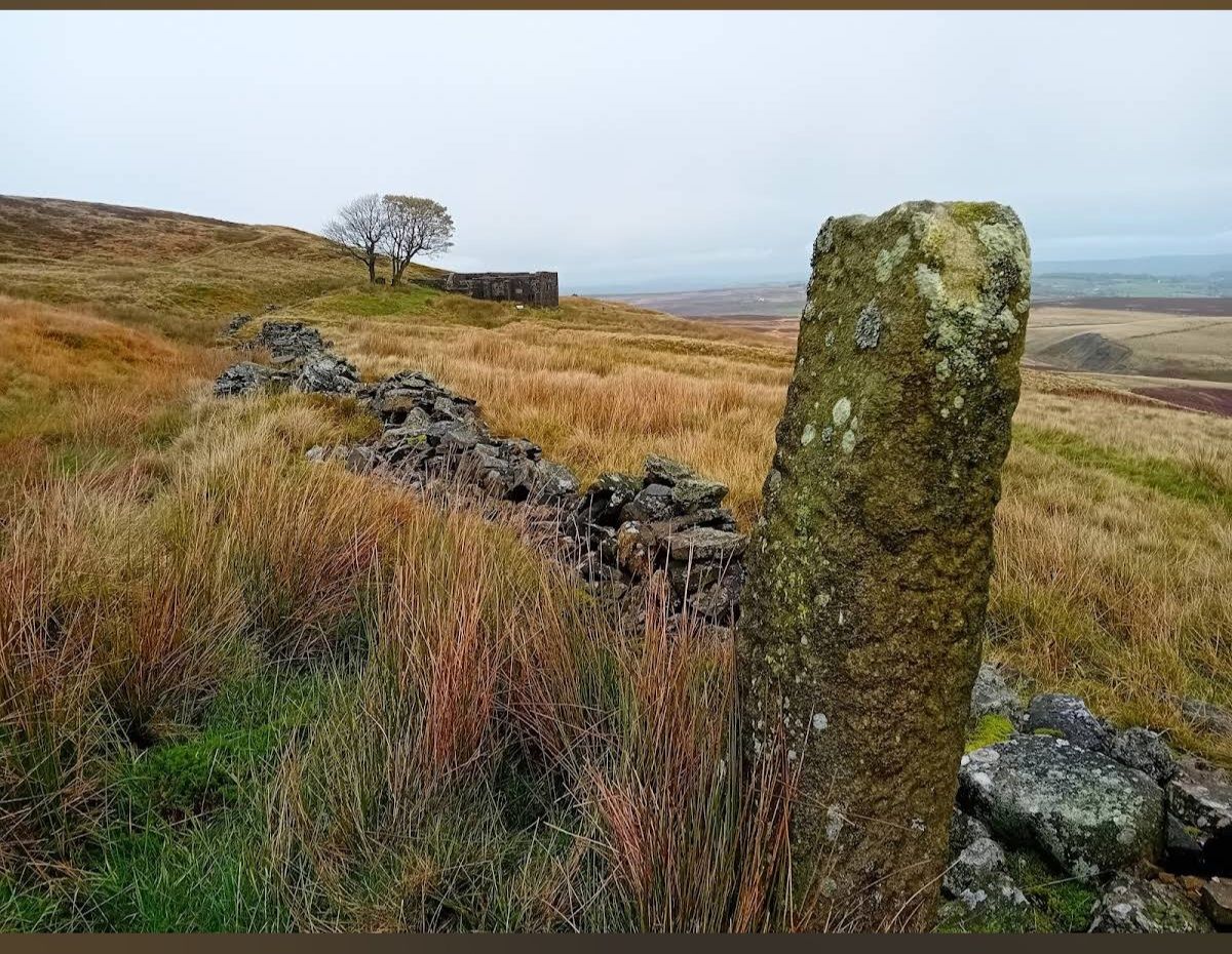
That is why the photographs matter.
Because planning documents rarely show what is truly at stake.
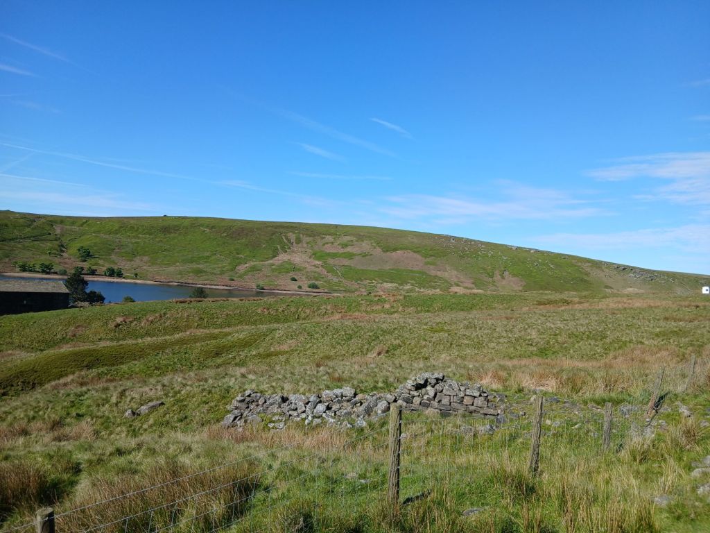
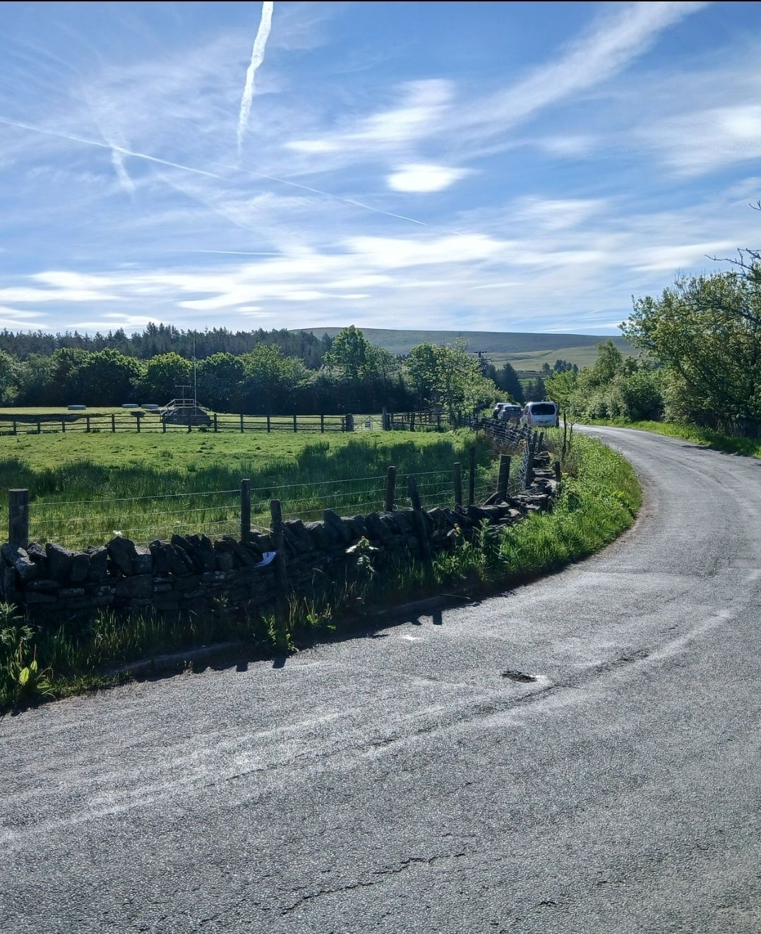
The images from the proposed turbine locations reveal an extraordinary landscape of sweeping valleys, exposed moorland, historic stone walls, reservoir systems, grazing land, peat moor, and heritage viewpoints.
This is not brownfield land.
It is not an abandoned industrial estate.
It is a living cultural landscape deeply tied to the identity of the South Pennines.
Top Withins itself is internationally recognised through its association with the Brontë landscape. Visitors travel from across Britain and overseas to experience the atmosphere of these moors The same atmosphere captured in the photographs: vast skies, silence, heather, ruins, and open valleys untouched by modern urban development.
The information boards on site describe the history of upland farming, the Pennine watershed, and the human story woven into this landscape over generations.
This is a place people come to escape industrialisation.
Yet the proposal risks introducing:
towering turbine structures;
rotating blades;
aviation warning lights;
crane hardstandings;
substations;
access roads;
excavation works;
and years of heavy construction activity
into one of Yorkshire’s most visually sensitive upland environments.
Supporters of the scheme will argue that development is necessary for renewable energy targets.
But difficult questions still remain.
Should nationally important moorland landscapes carry the burden of industrialisation when alternative energy strategies exist?
Should heritage landscapes associated with tourism, walking, recreation, and the cultural identity of the South Pennines be transformed into industrial energy zones?
And perhaps most importantly:
Has the wider public truly been shown what this proposal would mean on the ground?
Because once people see the landscape for themselves — not through planning jargon, but through photographs, topography, and lived experience , the scale of the change becomes very real.
So before decisions are made, the public deserves the chance to see exactly what is being proposed.
Look at the map.
Look at the Pennine Way.
Look at the valleys.
Look at the skyline.
Look at the photographs.
Then decide for yourself:
Is this really a place for industrial turbines?
Shane Oxer. Campaigner for fairer and affordable energy

Leave a comment